

The Remutaka Incline is the most elevated section of the original rail route from Wellington to the Wairarapa. Development of the route in the 1870s is an internationally renowned engineering achievement. Use of the line ceased in 1955 when the much more direct Remutaka rail tunnel opened. However, the Remutaka route and remaining structures are a significant Victorian engineering achievement, and a reminder of colonial efforts to improve access to the Wairarapa.
This historic area was registered under the Historic Places Act 1993. The following text is from the original Historic Area Assessment Under Section 23 Criteria report considered by the NZHPT Board at the time of registration.
DESCRIPTION:
The 16 kilometres of railway formation between State Highway 2 at Kaitoke and the former rail settlement at Cross Creek is now a popular walkway. It includes the historically significant Remutaka Incline. Annually, some 30,000 walkers, runners and mountain bikers use this rail trail.
The section of rail formation between the Summit and Cross Creek is known as the Remutaka Incline. It is a 4.8 kilometre stretch of steep mountain railway. Trains travelled the Incline to and from the Wairarapa from 16 October 1878 to 29 October 1955 when rail traffic was re-routed through the new Remutaka tunnel. The railway was twice as steep as the steepest mainline railway in New Zealand. A special 'Fell' system was employed to assist the locomotives grip the rails.
The Incline's formation, which includes embankments, tunnels, culverts and associated structures and occupation sites (Summit yard, Cross Creek and campsites), are archaeological sites as defined in section 2 of the Historic Places Act 1993. Trust authorisation is required for any works that might modify or damage these sites. Artefacts and remnants of railway structures continue to be found in the vicinity of the Incline, and many remain uncovered.
A lengthy part of the route is vested in the Wellington Regional Council which has allowed sections to be used as a logging route - with serious implications for maintenance of the formation. The Department of Conservation manages the area from Cross Creek to the Summit Tunnel under a conservation plan.
This historic area was registered under the Historic Places Act 1993. The following text is from the original Historic Area Assessment Under Section 23 Criteria report considered by the NZHPT Board at the time of registration.
DESCRIPTION:
The 16 kilometres of railway formation between State Highway 2 at Kaitoke and the former rail settlement at Cross Creek is now a popular walkway. It includes the historically significant Remutaka Incline. Annually, some 30,000 walkers, runners and mountain bikers use this rail trail.
The section of rail formation between the Summit and Cross Creek is known as the Remutaka Incline. It is a 4.8 kilometre stretch of steep mountain railway. Trains travelled the Incline to and from the Wairarapa from 16 October 1878 to 29 October 1955 when rail traffic was re-routed through the new Remutaka tunnel. The railway was twice as steep as the steepest mainline railway in New Zealand. A special 'Fell' system was employed to assist the locomotives grip the rails.
The Incline's formation, which includes embankments, tunnels, culverts and associated structures and occupation sites (Summit yard, Cross Creek and campsites), are archaeological sites as defined in section 2 of the Historic Places Act 1993. Trust authorisation is required for any works that might modify or damage these sites. Artefacts and remnants of railway structures continue to be found in the vicinity of the Incline, and many remain uncovered.
A lengthy part of the route is vested in the Wellington Regional Council which has allowed sections to be used as a logging route - with serious implications for maintenance of the formation. The Department of Conservation manages the area from Cross Creek to the Summit Tunnel under a conservation plan.
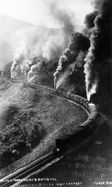
Remutaka Incline Rail Trail. A photograph of a postcard showing a train with four engines travelling up the Rimutaka incline. Image courtesy of Wairarapa Archive ref. 90-17-142 | Wairarapa Archives
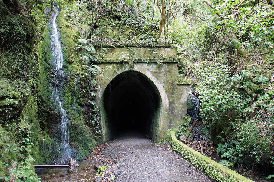
Remutaka Incline Rail Trail. Summit Tunnel North End. Image courtesy of www.flickr.com | Hugh McCall – Braxholm | 17/04/2012 | Hugh McCall
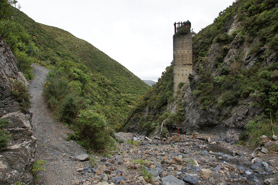
Remutaka Incline Rail Trail. Remains of the embankment that crossed Horseshoe Gully, also known as 'Siberia' curve, with the drainage inlet column satnding prominently. Image courtesy of www.flickr.com | Hugh McCall – Braxholm | 17/04/2012 | Hugh McCall
Remutaka Incline Rail Trail. A photograph of a postcard showing a train with four engines travelling up the Rimutaka incline. Image courtesy of Wairarapa Archive ref. 90-17-142 | Wairarapa Archives
Remutaka Incline Rail Trail. Summit Tunnel North End. Image courtesy of www.flickr.com | Hugh McCall – Braxholm | 17/04/2012 | Hugh McCall
Remutaka Incline Rail Trail. Remains of the embankment that crossed Horseshoe Gully, also known as 'Siberia' curve, with the drainage inlet column satnding prominently. Image courtesy of www.flickr.com | Hugh McCall – Braxholm | 17/04/2012 | Hugh McCall
